Sriharikota – After the buzz of Shubhanshu Shukla’s Axiom-4 mission, India is back in the space spotlight with a game-changing collaborative effort between ISRO and NASA. The Nasa-Isro Synthetic Aperture Radar (NISAR) mission is poised to reshape the way we monitor and understand our planet.
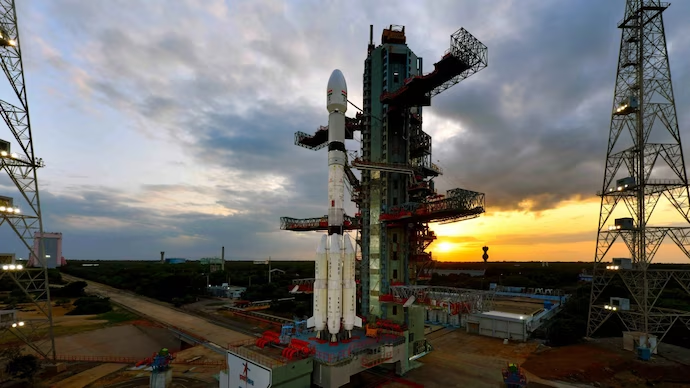
Slated for launch aboard the GSLV Mk-II rocket from the Satish Dhawan Space Centre, the NISAR satellite is no ordinary payload. It’s a $1.5 billion venture (₹12,500 crore), with India contributing ₹788 crore (approximately $96 million) — a strategic investment for access to cutting-edge, real-time Earth observation data.
What Makes NISAR a Scientific Marvel?
NISAR is the world’s first dual-frequency synthetic aperture radar satellite. It combines NASA’s L-band radar with ISRO’s S-band radar, enabling it to penetrate clouds, vegetation, smoke, and even darkness. The satellite can detect minute changes in the Earth’s surface — as small as a few millimeters.
Key capabilities include:
-
Monitoring glacier and polar ice movements
-
Tracking seismic fault lines and earthquakes
-
Measuring land subsidence due to groundwater depletion
-
Analyzing deforestation, urban expansion, and soil moisture
Orbiting Earth every 97 minutes, NISAR will map nearly the entire land and ice-covered surface of the planet every 12 days. Its open-source data will be freely accessible to scientists, disaster management agencies, and climate researchers across the globe.

What India Gains from NISAR
Despite contributing a fraction of the mission’s cost, India secures several high-value returns:
-
Full access to premium Earth observation data
-
Technological leadership through development of the S-band radar and indigenous GSLV Mk-II launch
-
Enhanced disaster response capabilities for floods, landslides, and earthquakes
-
Support for India’s climate goals with tools to monitor glacier retreat, manage agriculture, and conserve water resources
-
Boost to global scientific standing through meaningful space collaboration with NASA
From predicting floods in Assam to measuring the pace of Himalayan glacier melt, NISAR is poised to become a cornerstone of India’s environmental and technological strategy.
As the countdown begins, NISAR represents not just a satellite launch, but a leap toward global climate resilience, scientific collaboration, and strategic autonomy in space-based Earth monitoring.